Bellingham, WA
Port of Bellingham Sea-Level Rise Web Viewer
Client Name
Related Service
Related Sector
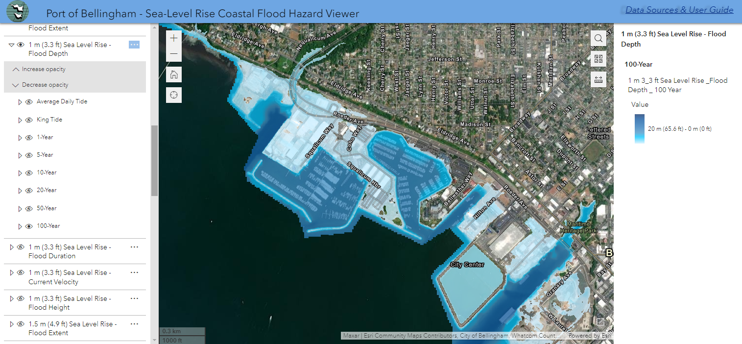
MFA designed and built a sea-level rise web map application for the Port of Bellingham. The web map is a critical tool for the port as they develop a climate adaptation strategy to prioritize construction and maintenance projects in the face of expected sea-level rise and the changing likelihood of a catastrophic coastal storm surge. Applying our experience developing coastal hazard data and maps, MFA evaluated numerous flood scenarios developed by the U.S. Geological Survey, determined which scenarios were most important, and designed a tool that is visually concise and easy-to-use for the Port’s climate resilience efforts.
Learn More
Contact Us!
Thank you for your interest in MFA! Whether you are looking to inquire about a project or are interested in learning more about our services, please reach out to the MFA Team!